Deserts and semi-deserts in Russia do not occupy such a large territory of the country and are distributed only in the desert part of the Caspian lowland. Also among the semi-deserts in the regions of the Volgograd region you can find the Archedinsko-Don sands, and in the territories of the Volgograd and Rostov regions.
The climate of deserts and semi-deserts is very harsh - the soil is saline, these are gray soils and gray-brown desert soil. But despite all this, the vegetation here is quite diverse and consists of small superficial plants with a powerful root system.
What plants grow in deserts and semi-deserts:
| Sagebrush |
| Poa bulbous |
| Camel-thorn |
| Solyanka |
| Ephedra two-spikelet |
When we talk about the desert, first of all we imagine sandy expanses where there is no water, no animals, no plants. But such a landscape is not ubiquitous, and nature in the desert can be very diverse. Deserts are home to several species of birds, mammals, herbivores, insects and reptiles. This means they have something to eat in the desert.
Despite the hot and dry climate, strong winds and sandstorms, and lack of precipitation, representatives of the animal world are able to survive in such conditions. Some species of flora have also adapted to these conditions.
Ryn-Peski – the border of Kazakhstan and the Astrakhan region
- Length = 160 km
- Area = 40000 sq.m.
Scientists believe that on the site of the Russian desert 70 thousand years ago there was a large lake. Here you can even find shells in the red and yellow sand! Thanks to wells located here and there, local residents founded several settlements, they built houses and even raised livestock. The desert is known for its rich history - in the 12th century the center of the Golden Horde was located here, and it was from here that the campaigns of nomadic peoples began.
Special territories
Most of the deserts and semi-deserts of our country are located on territory that was once nothing more than the seabed. Today this part of the continent is the Caspian Lowland, which is famous for its very unique landscape. The completely flat surface stretches here for many kilometers, literally touching the horizon. Only the western region of the desert zone of Russia looks a little more lively - here you can find small rounded hills, the basis of which is rock salt, and steep slopes of Eregeni.
Geographical location and natural conditions
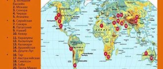
Arctic desert, as well as deserts and semi-deserts on the map of Russia
In the area of the left bank of the Volga, deserts and semi-deserts stretch to Kazakhstan. The lands from the right bank of the river extend to the foothills of the Caucasus. The territories lie on the Caspian lowland, which is an area with flat topography. Millions of years ago there was a seabed here. Most of the deserts are a flat land surface, and only in the west are there steep slopes.
Climate
The natural zone is located in an area of sharply continental climate. Rain and snow fall infrequently, making the climate dry but harsh. Most precipitation occurs in spring and summer. The level of evaporation exceeds the amount of precipitation. The desert experiences strong daily and annual temperature ranges. During the day, the temperature difference can reach thirty degrees Celsius. In winter, the thermometer drops to -30°C and the winds rage. Their gusts blow away the snow cover from the soil, causing it to take on a black tint. Summer temperatures exceed +40°C. It rains rarely, but dust storms and dry winds often occur.
Vegetable world
The soils in semi-deserts are saline because they are based on ancient marine rocks. Wormwood-grass vegetation grows in semi-deserts. The lands contain little humus, and as a result of human economic activity they turn into shifting sands, and therefore are infertile. Nevertheless, the vegetation cover of the natural area is variegated. Feather grass, fescue, white wormwood, black wormwood, desert wheatgrass, and viviparous bluegrass grow here. From April to November, semi-desert lands are used as pastures. In June, with the onset of the dry period, the vegetation disappears, and the semi-desert becomes like a desert.
Closer to the south, the climate becomes arid, and the lands turn into a real desert. It is usually divided into two subzones: northern and southern. In the northern part the climate is mild. Subshrubs dominate here: saltmarsh barnacle, gray quinoa, and redberry. Desert plants adapt to living conditions; many of them are leafless to reduce moisture evaporation. Vegetation in one form or another is located throughout the desert. In the southern part there are small trees and shrubs: sand acacia, Richter's solyanka, white saxaul. These areas also serve as pastures.
Animal world
The semi-desert and desert zones are home to many rodents that have adapted to harsh conditions. Animals dig deep holes to wait out the heat of the day in them. Jerboas, gophers, mice and voles have developed optimal conditions for existence in the harsh conditions of the natural zone.
Reptiles such as lizards and snakes bury their bodies in the sand to escape the heat. They are nocturnal. The order of predators is represented by the steppe fox, steppe polecat and wolf. A well-known large mammal is the saiga antelope. This antelope develops high speeds. The class of birds is also diverse. Here you can see white-winged lark, steppe eagle, white heron and bustard.
Curonian Spit
- Where:
Kaliningrad region and Lithuania - Size:
0.4 to 4 km wide and 90 km long - #Curonian braid:
265,108 posts on Instagram
This is definitely the most popular sand-related object in Russia. The Curonian Spit is a narrow strip of land that separates the Curonian Lagoon from the Baltic Sea. Hundreds of thousands of tourists come here every year. And in 2000, the Curonian Spit was included in the UNESCO World Heritage List.
Ecological trail “Dancing Forest”
The entire spit is part of the Curonian Spit National Park. A permit to visit for one day costs 300 rubles, an additional payment for travel by car is 150 rubles per car. You can pay on the website. Part of the park is a protected area that cannot be visited even with a permit.
Lighthouse in the village of Rybachy
The Curonian Spit is a fantastic combination of sand and water. There are ecological trails and cycling routes on the territory. The most popular place is the Efa dune, 55 meters high. In the village of Rybachy, 19th-century architecture and a Lutheran church have been preserved. The 2-kilometer ecological trail “Müller Height” begins from Rybachy. In the village of Lesnoy there is a lighthouse, which is popularly called the “Love Floor Lamp”. And if you don’t want to be active, you can simply come to a deserted beach to watch the sunset.
Exit to the beach on the Curonian Spit
Recently, the only glamping site on the Curonian Spit, Polyana, was opened in Lesnoy. A night in a double tent costs 12,500 rubles in summer and 7,900 in spring and autumn.
How to get there.
The Curonian Spit begins on the outskirts of the city of Zelenogradsk. You can get from Kaliningrad by train, the journey takes 20–30 minutes. Or by bus, which runs four times a day to the village of Morskoye. The journey takes 2.5 hours. There are also buses from Zelenogradsk to Morskoye. Therefore, perhaps a combination of train and bus will be faster.
To see the most attractions, it is better to go by car. In Kaliningrad you can rent a car for 2000–2500 rubles per day.
Location of natural areas on the map of Russia
Deserts and semi-deserts of Russia are located in the southeastern part of the East European Plain along the Caspian Sea. This is the territory of Kalmykia, Astrakhan and Volgograd regions.
Small semi-deserts exist in the Volgograd and Rostov regions (we are talking about the Archedinsky-Don and Tsimlyansky sands). In the southern direction from Volgograd and the left bank of the Volga to Kazakhstan, and from the south to the Terek and the foothills of the Caucasus range, the steppes turn into desert.
Arctic deserts stretch from the Murmansk region to Anadyr to the north and east of the country. It includes the ocean coast from Murmansk to Taimyr and Chukotka, as well as all the northern Russian islands. The map shows that deserts occupy only a small part of the state's territory.
Barkhan Sarykum
- Where:
Korkmaskala village, Dagestan - Size:
2×0.7 km - #sarykum:
13,572 posts +
#sarykumbarkhan:
2005 posts
Sarykum is the largest single dune in Europe, its height is 250 meters. These are usually found only in deserts. Scientists cannot give an exact answer as to how it appeared in the foothills of the Caucasus. An episode from “White Sun of the Desert” with the buried Said was filmed here.
Anatoly Kuznetsov (Sukhov) and Spartak Mishulin (Said) in the film “White Sun of the Desert.”
This used to be one of the most popular attractions in Dagestan. And after the republic became a trending destination, Sarykum began to appear even more often on the Instagram feed.
Barkhan is part of the Dagestansky Nature Reserve. To get into it, you need to buy a ticket for 50 rubles. The sand is not so easy to walk on, so there are wooden boardwalks that lead to the highest point. You need to be careful when lying on the sand and walking barefoot: there are poisonous animals here - the viper snake, scorpions, salpuga spiders and karakurt. Not far from the dunes are the picturesque ruins of the Kum-Torkale railway station.
Barkhan Sarykum
How to get there.
The easiest way to get to Sarykum is by taxi from Makhachkala; it will cost 500–700 rubles. You can save money and take a minibus to the village of Korkmaskala.
Plants
Semi-deserts
They are characterized by such plant species as tree and gnarled saltwort , camel thorn, and juzgun . The higher elevations are dominated by feather grass and fescue .
In the desert zone there is the delta of the longest river in Europe - the Volga. Here is the unique Volga-Akhtuba floodplain, which is often called an oasis. This area is home to luxurious lotus fields.
Deserts
Typical plants are ephemerals - low, small, with a very short growing season. They become active during more or less humid periods, drying up at other times and showing no signs of life. In the deserts of the Caspian lowland, wormwood rules.
Desert plants (for example, wormwood) have adapted to harsh conditions: protective caps on the roots protect them after sand is blown out
The opinion that the desert is a completely lifeless space is wrong. There is vegetation here, but it does not form a continuous cover
Dune hillocks tract (“Don Sahara”)
- Where:
Dedovka village, Voronezh region - Size:
2.5×0.9 km - #Donskayahara:
311 posts on Instagram
The main version of the appearance of a tract (a small area of landscape) in the middle of fields and meadows is the cutting down of the forests themselves and uncontrolled grazing of livestock. The plants no longer held back the sand, and the wind carried it around the surrounding area, increasing the area. Over time, the sand was brought under control and the area was replanted with plants. Now the small dune is under protection. In 1959, Moscow photographer Vasily Peskov called this place “Don Sahara”, and all the locals now don’t call it anything else. And the official name “Dune Hills” appears only on signs.
Dune hills. Photo: Andrey Konyukhov / Instagram
How to get there.
You must first get to the village of Dedovka - 300 kilometers from Voronezh and Rostov-on-Don. And then turn onto one of the dusty dirt roads that lead to the tract and drive another ten kilometers. Along the way you can look into a dilapidated church from the late 19th century. If you are not driving a jeep and do not have experience driving on sand, it is better to leave the car before the sandy dirt road begins and walk.
Access to the tract. Photo: Andrey Konyukhov / Instagram
Ecological problems of deserts and semi-deserts of Russia
The main threat to turning deserts into wastelands is human intervention. Recent scientific research has shown that these areas contain deposits of oil and natural gas. Due to technological progress, the need for them is constantly growing. Oil production pollutes nearby areas more than others. The release of “black gold” into the environment entails an environmental disaster.
The desert and semi-desert zones of Russia are home to many different species of animals, some of which are listed in the Red Book. Poaching puts the survival of valuable animals into question. The process of desertification itself causes damage to agriculture. The number of pastures is decreasing.
Due to anthropogenic influence, ice in the Arctic is melting, as a result of which the Arctic desert zone itself is shrinking. If it disappears, a large number of flora and fauna will disappear from the face of the Earth. Snowmobiles and other ground vehicles pollute the atmosphere with exhaust emissions. Ozone holes negatively affect animal life. The ecosystem is destroyed by mining, waste, and water pollution. Large fish species are under threat of extinction. Their food, small fish and seafood, is caught on an industrial scale.
Deserts and semi-deserts need our protection. Already today there are nature reserves in the territories, but this is not enough. Work to protect natural areas must be controlled at the state level. Every effort should be made to resolve existing problems so that new ones do not arise.
Didn't you find everything? Use site search ↓
Dunes in Choine
- Where:
Shoina village, Nenets Autonomous Okrug - Size:
coastal strip 6×1.3 km - #shoina:
639 posts on Instagram
The village of Shoina is located on the shores of the White Sea in the Nenets Autonomous Okrug on the Kanin Peninsula. This is a sparsely populated tundra, where there are no roads, and the nearest city, Mezen, is 250 kilometers in a straight line. About 300 people live in Shoine. But despite its remoteness and small size, the village is quite famous - reports are written about it and documentaries are made. The reason for this popularity is the sand, which is gradually absorbing the village and filling up some houses. And it looks incredibly picturesque.
House in Shoine. Photo: Mikhail Mityukov
It is still unknown exactly why the sand began to take over the area. According to one version, this happens because in Soviet times, due to massive fishing, trawls destroyed bottom vegetation. And now, during low tides, the wind easily carries the sand further and further from the shore. How to get there.
Very difficult and very expensive! In the summer, one plane (or helicopter) per week flies to Shoina from Arkhangelsk - “2nd Joint Air Squadron” and Naryan-Mar - “Naryan-Mar Joint Air Squadron”. The rest of the time - once every two weeks. A round-trip ticket from Arkhangelsk costs 30 thousand rubles, from Naryan-Mar - 22 thousand. But the uniqueness of the place and the picturesque surroundings justify the costs. Here you can immerse yourself in the natural life of Pomor villagers, see how Nenets reindeer herders live in the tundra, collect cloudberries and cranberries, catch flounder, ride homemade all-terrain vehicles that every resident has, and meditatively watch sunsets while sitting on a sand dune.
Along the sands on a homemade all-terrain vehicle.
Photo: Mikhail Mityukov If you wanted to find a harsh, but picturesque and quiet place to write a book, Shoina is perfect for this task.
Tsimlyansk Sands
Tsimlyansky Sands is a natural park in the Volgograd region, where many tourists come. Unfortunately, most of them complain about garbage. There are no high dunes here, there are only sandy mounds. Nearby is the Tsimlyanskoye Reservoir - one of the most fishing places in Russia.
Desert Russia Travel
Tsugeer-Els Dunes
- Where : Erzin village, Republic of Tyva
- Size : 49 km²
- #tsugeerels: 1 post
The density of Tyva is less than two people per square kilometer, and if it were a country, it would rank last in the world in terms of this indicator. Therefore, the human impact on nature here is minimal, and animals - camels, yaks - are constantly encountered. The Tsugeer-Els sands are part of the Ubsunur Basin Nature Reserve. And a visit to this place is an opportunity to see not only the dunes, but also the deserted nature of Tuva with snow-capped ridges.
Dunes Tsugeer-Els. Photo: Dana Khovalyg / Instagram
How to get there.
It is possible to visit these places only with your own car, and it is advisable that it be an SUV. The reserve's website lists a 4-day tourist route, which includes a visit to the dunes. But there are no more details, so it’s better to call +7 39422 5 37 87.
Author: Misha Mityukov.
Subscribe to us on social networks : telegram channel, Vkontakte, Facebook, Yandex.Zen, Instagram.
Aridity
deserts can be explained by two reasons. Temperate deserts are arid because they are far from the oceans and inaccessible to moisture-carrying winds. The dryness of tropical deserts is due to the fact that they are located in an area of prevailing downward air currents coming from the equatorial zone, where, on the contrary, strong upward currents are observed, leading to the formation of clouds and heavy precipitation. As air masses descend, already deprived of most of the moisture they contain, they heat up, moving even further away from the saturation point. A similar process also occurs when air flows cross high mountain ranges: most of the precipitation falls on the windward slope during the upward movement of air, and areas located on the leeward slope of the ridge and at its foot find themselves in the “rain shadow”, where the amount of precipitation is small.
Desert air everywhere is extremely dry. Both absolute and relative humidity are close to zero for most of the year. Rainfall is extremely rare and usually falls in the form of heavy downpours. At the Nouadhibou weather station in western Sahara, the average annual precipitation according to long-term observations is only 81 mm. In 1912, only 2.5 mm of rain fell there, but the next year one very heavy rainfall brought 305 mm. High temperatures, which increase evaporation, also contribute to desert aridity. Rain falling over the desert often evaporates before reaching the surface of the earth. Most of the moisture that reaches the surface is quickly lost through evaporation, and only a small proportion seeps into the ground or runs off in surface watercourses. Water that seeps into the soil replenishes groundwater and can travel long distances until it emerges as a spring in an oasis. It is believed that most deserts can be turned into blooming gardens through irrigation.
This is generally true, but great care is required when designing irrigation systems in arid areas where there is a risk of large losses of water from irrigation canals and reservoirs. As a result of water seepage into the ground, the groundwater table rises, which, under conditions of an arid climate and high temperatures, leads to capillary pull of groundwater to the surface and evaporation, and salts dissolved in these waters accumulate in the near-surface soil layer, contributing to its salinization
California Death Valley
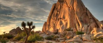
The Mojave is a desert whose plants and animals are quite diverse. Despite the intimidating name, this part of California is not so lifeless. For example, tree-like yucca and creosote bushes are quite common here, the flowers of which vary in color from white to bright yellow, depending on the species.
In some areas, Coleogyne is common, the flowering of which is very diverse in both tone and shape. Teresken, which is also called desert buckwheat, is also found quite often in more or less humid parts of the desert.
Ocotiyo lights up with bright red, almost orange candles in the spring, its inflorescences rising high above the surface of the Mojave shrubs. At the same time, numerous burro bushes bloom. Individually, the flowers of this plant are somewhat similar to mustard flowers, however, hundreds of such light yellow buds bloom on each branch, which makes the bush a little fluffy visually.
An amazing land - the desert. The plants and animals here are truly unique. It’s hard to even imagine how rich and diverse this paradise is, existing for a short moment.
Purple, red, orange, yellow, white and pistachio are all the colors that the Mojave turns into in the spring, only to return to an arid grayish-red color within a few days until the next rain showers.
What plants grow in the desert (names and pictures)?
The desert landscape of the Karakum Desert and the Ustyurt Desert is defined by woody and semi-woody desert plants.
In addition to saxauls with their roots going 40-60 meters deep to the layers of water, and tamarix growing above salty water lenses, we need to remember sand acacia (several species), kandym (also many species). It is they, up to 3 meters high, that are called desert trees.
There are also shrubs up to 1 meter high in the desert: curly grass, bindweed, tree-like saltworts, blackberries. Subshrubs in which most of the plant dies off in winter: wormwood and the same solyanka, of which there is a large variety in the desert.
And there is not so little grass in the desert. These are ephemeroids with their underground storage organs (bulbs and rhizomes), which come out annually for several weeks in the spring to live out their cycle. And also - ephemerals, herbs whose seeds germinate only in a wet year. If the spring is wet, then the desert is no less green than the lawns in the temperate zone. But all this doesn’t last long. In a couple of months, desert herbaceous plants should have time to form seeds and die off.
Here is a list of ephemeroids: goose onions, tulips, broomrapes, irises, hornpetals, eremuruses, desert sedge-silt, and that’s not all!
Ephemera: amberboa, strigozella, arnebia, cornea, mortuk, bulbous bluegrass and about a hundred other species.
Of course, the deserts of Africa and America have a different species composition.
To adapt to growing in the desert, plants had to adapt well to its harsh climatic conditions - the roots became longer, the leaves became smaller (to reduce the area of evaporation of valuable moisture). Here are typical desert plants:
- cacti
- Xerophytes
- Lithops
- Carnegia gianta
